Spurn Point Low - Spurn Point, East Riding of Yorkshire
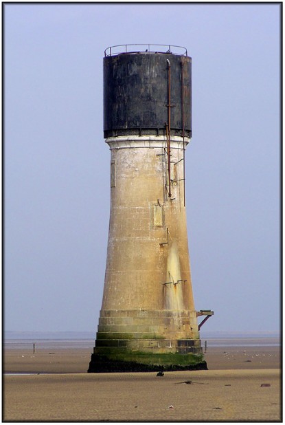 | Lighthouse category: coastal Position: 53°34' 44.26"N : 0° 6' 57.56"E Status: inactive Date: 1852 Designer: not known Tower height: 90 feet Construction: round stone tower (lantern removed) Colour scheme: once white, now unpainted Focal plane height: not applicable Characteristics: not applicable Foghorn: not applicable Google map view: google map link |
This photograph shows the mortal remains of the final light in the sequence of Low Lights at Spurn. This one was built in 1852 and lasted until 1895 when it was rendered redundant by the latest High Light. I have read several references that refer to this as a "brick tower" but, from the evidence in this image, I believe that to be false (perhaps confusion resulted from an earlier brick built tower in roughly the same spot). This tower (or what's left of it) certainly appears to be of stone construction. Close examination of the original image reveals that some of the original white paintwork is still clinging tenaciously to the tower. Spurn was once an important military installation with coastal artillery guarding the entrance to the Humber and, for a while after it was deactivated, the Low Light was used as an explosives store. Later still a water tank was installed on top of the tower and this is still in place. At low tide the tower can viewed from any angle that takes your fancy so lighting shouldn't be a problem.
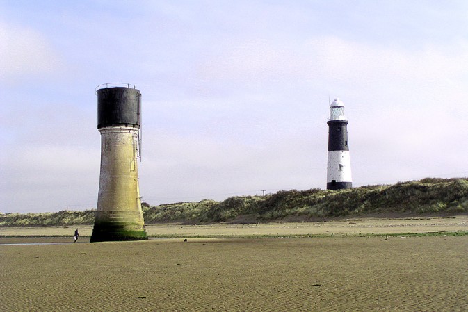
The photo below shows both the truncated Low Light and the redundant High Light and gives some idea of the original range alignment.
The photo below shows both the truncated Low Light and the redundant High Light and gives some idea of the original range alignment.