Longstone Lighthouse - Farne Islands, Northumberland
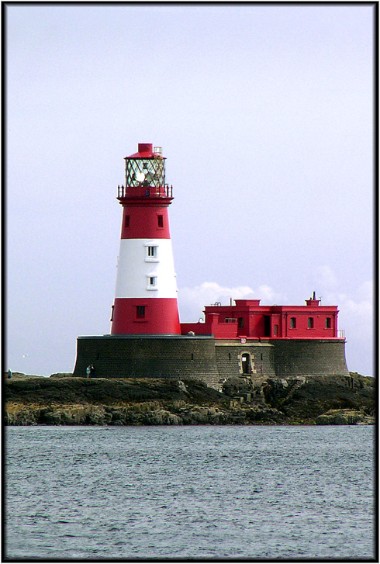 | Category of lighthouse: coastal Position: 55° 38'.63 N 01° 36'.58 W Status: active aid to navigation Date: 1826 Designer: Joseph Nelson Tower height: 85 feet Construction: stone Colour scheme: red with broad, white, horizontal band Focal plane height: 92 feet Characteristics: white flash every 20 seconds Foghorn: 2 blasts every 60 seconds Google map view: |
Of course, the story of the Longstone Lighthouse is inextricably associated with the story of the great popular Victorian heroine, Grace Darling. But that story is too long and too well known to be retold here. For anyone not familiar with the tale of gallantry on the high seas, you can find a short Wikipedia article here. Being a rock lighthouse, and situated a considerable distance offshore, photography of the Longstone from the mainland is impossible, but there are several boat trips available from Seahouses, some of which permit passengers to land on the island, and some of which also stop at Inner Farne (q.v.). This photograph was taken in the course of one such trip on 17 August 2003. As I had driven up from York for the day, time was not on my side, so I opted for one of the round trips that didn’t land on any of the islands. However, the weather was good, giving me plenty of opportunities for the use of varied angles that made the most of the light. This is also an excellent area for photographing wildlife with plenty of seals around and numerous different species of seabird.
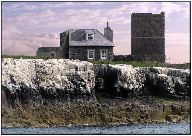
An earlier, coal fired light, also associated with the Darling family, was maintained for a while on Brownsman Island close to the Longstone. However, coal fired lights were generally unsatisfactory and when The Corporation of Trinity House assumed responsibility for the English lights, they decided to build two new lights one on the Longstone Rock and the other on Inner Farne. However, the remains of the Brownsman Island light are still there, and the stump of the tower and the partially demolished keeper's cottage can be seen in the following photograph. Google Maps has an aerial view of the island here